TODAY: Warm & Humid, Scattered T-Storms 4-11pm. Hi 88.
TONIGHT: Lingering Showers. Lo 69.
THURSDAY: Mostly Cloudy, Stray Showers. Hi 80.
Yesterday was another warm and muggy mid-September day across Central PA. It was similar to Monday, and both days to start the week have stayed rain and storm-free. That changes today. It looks to be our most active day of the week as a cold front slides through Pennsylvania this evening. This will lead to a line of broken storms by evening with damaging wind gusts the primary severe weather concern. Additional showers and t-storms could develop after sunset which could mean locally higher rainfall amounts (1″+) where training occurs. Isolated flash flooding is still a concern because of this, given the heavy rains so far this month. Showers will linger overnight too. Highs today will be in the upper 80s, with lows tonight falling into the upper 60s.
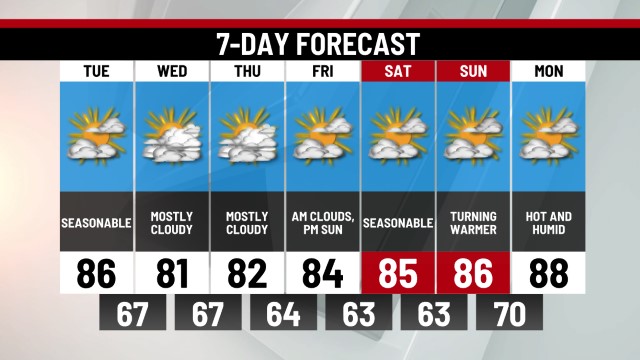
The front will be east of us Thursday, but an east flow combined with a tropical low off the coast will throw us more clouds and a few showers throughout the day. It will by no means be a washout, however, and some sun may even peek out in our western counties from time to time. This pattern will continue into Friday before a gradual drying trend occurs late Friday into the weekend. We should be back to lots of sunshine by Sunday but highs will start to rebound into the mid-80s again early next week.
Highs the next few days will remain well above average, but a brief return to more seasonable temps is expected Thursday and Friday mainly because of the cloudy skies. No signs of a drastic push of cool, dry air appear anytime soon. Therefore, expect much of the rest of September to be seasonable to warmer than average.
-Meteorologist Brett Thackara


0 Commentaires