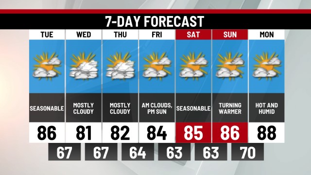
TODAY: Patchy Fog Early, Then Partly Cloudy & Warmer. Hi 85.
TONIGHT: Mostly Clear. Lo 65.
SATURDAY: Mostly Sunny & Hot. Hi 90.
SUNDAY: Mostly Sunny & Hot, Ridge-Top T-Storm. Hi 92.
Yesterday was a unique day for Pennsylvania with areas west and east of the mountains having two totally different types of days. Locally, Thursday felt like a Spring day rather than an early summer one. The problem was a front stuck over the region and a persistent light east flow. The moisture would not break, at least until it was too late in the day. High temperatures occurred early in the evening ranging from the upper 60s to the lower 70s. It was cool and cloudy and Central PA was stuck! Moisture lingered through last night with areas of drizzle and fog. The fog is patchy this morning and will be stubborn to burn off. Conditions should turn much sunnier starting late this morning for most though! This afternoon will be partly cloudy and pleasant with highs in the mid-80s!
Saturday should be dry with heat and humidity ramping up a bit too, but it won't be oppressively humid. Saturday’s highs could reach 90° while we break into the low 90s Sunday. While a late-day ridge-top t-storm is possible Sunday, there doesn’t appear to be much of a trigger for storm activity this weekend. Therefore, the entire weekend is likely to be dry for most locations. Monday could bring some scattered showers as a cold front marches through Pennsylvania. Behind the front, Tuesday looks sunny and comfortable. It doesn’t appear that much rain is on the way in the next 7-10 days. Get ready to water your lawns and gardens because it may be needed over the coming days and weeks. Enjoy the summery weather, we’ve got plenty of it coming!
-Meteorologist Brett Thackara


0 Commentaires