Aired; January 25th, 2024.
Last week’s cold and wind and even the most snow in two years have been followed by warming temperatures and rain this week. The winter weather last week was typical of years past but seemed to have a real impact on many Central Pennsylvanians who have grown accustomed to milder winter temperatures and little snow.
That wasn’t the case eight years ago this week when Central Pennsylvania got nailed with more than 30 inches of snow.

ABC27 meteorologist Dan Tomaso
On The Spark Thursday, ABC27 meteorologist Dan Tomaso said the snow and cold last week seemed almost novel to many Central Pennsylvanians,”The reason I think I view it that way is I had more questions than ever about closures, delays, people saying, well, we just haven’t had this. I mean, I’ve heard that several times now, that we just haven’t had this active winter weather, we haven’t had to worry about closings and delays. And, the school districts kind of get off easy now that there’s this virtual thing and but, for day cares, which now I’m actually involved in, in daycare, whether, it’s with my child or other people’s kids here at work, everyone wants to know, is this enough to close? And to be honest with you, I never think three inches of snow is enough. But I think what made last week unique is that because it was so cold, everything’s stuck right away. So whether it was light snow, whether it was heavy snow, it was accumulating quickly. I think people really freak out when you don’t see blacktop when you’re driving or you don’t see the highway while you’re driving.”
Tomaso indicated he thought temperatures would stay moderate or mild with more rain into mid-February.
It’s much different than this week in 2016 when a major storm blew into Central Pennsylvania,”It was simply something we hadn’t seen before. Always when I do school visits, when I do talks to the public, I say to them, one of the great parts of my job is it’s something different every day. But this was something completely different. Essentially, this was a coastal snow storm that developed, and not only did it develop, it’s strengthened instead of usually these storms strengthen over the northeast and you get a lot of wind. I mean, that’s where the term nor’easter comes from, very strong winds from the northeast. But this one strengthened and deepened and slowed down right over the Mid-Atlantic. And so we were in the northwest corner of the storm, which is the sweet spot for heavy precipitation. And we were in it for over 12 hours. And not only that, some of the highest snow rates I’ve witnessed. So we we think about things in terms of rates. Are we getting one inch per hour. We get two inches per hour, three inches per hour. This thing was dumping 2 to 3 inches per hour.”
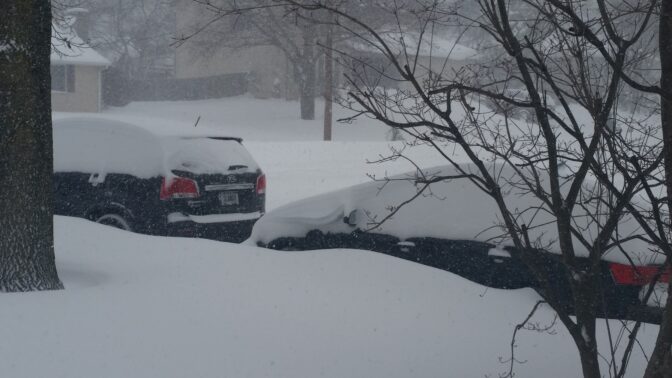
Scott LaMar/WITF
January 2016 storm


0 Commentaires